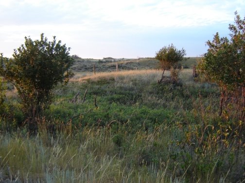
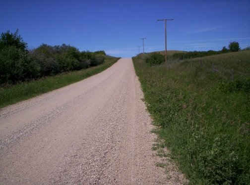
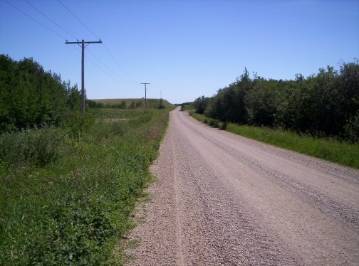
Showing posts with label hills. Show all posts

Thursday, February 01, 2007

"Mountain Hills to Prairie Flats"

...is the subtitle of the history book for our area: Arcola/Kisbey Golden Heritage. I know, some folks don't think they even count as hills, let alone "mountain hills," but it all depends on your point of view.

Check out the pictures on the website. Even if you're not planning on submitting an item, take a look at the submission guidelines page. If I'm not mistaken, that picture was taken a couple of years ago, around the same time that I was running from door to door telling people to look out at the sky. Ever heard of a zenith arc?

Monday, September 04, 2006

Five Sisters Found

Madcap Mum posted a picture of an odd-looking hill, and it drew a lot of questions. Some thought it was a modified image, with a fanciful landform plopped into it, but to me the hill looked quite believable as an industrial feature.

Some Googling revealed that the "Five Sisters" hill is a real place in Scotland, also known as the Westwood Bing. Here's the pdf document where I found out about it. The document as a whole is a fascinating discussion of the way old industrial sites are often important habitat, with much higher biodiversity than agricultural land. Attempts to manage this habitat throw some stark, disturbing light on the question of "what is nature?"

But in case you just wanted to know about the hill, here's an excerpt.
Five Sisters

The most spectacular remains of the great West Lothian oil industry have received national recognition and protection. The conical mounds of waste shale, called bings, once dominated this landscape. Many had disappeared by the end of the 20th century but the best-known, the Five Sisters and Greendykes bings, have been designated as scheduled ancient monuments by Historic Scotland.

The industry used local shale to extract crude oil, which was then turned into paraffin. At its peak in the 1860s, there were 120 works, producing 25 million gallons of oil a year.

Miners came to the area from Cornwall, Wales, Ireland, the north of England and all over Scotland. When the industry collapsed in the early 1960s, the bings contained 200 million tons of waste shale. Many were mined for building material. But the rest became important local landmarks. The Five Sisters, the only bing with more than one peak, is valued so highly that it is now included in the county crest.
The document has a picture of the bing from the opposite angle, showing the steep fall slopes of the peaks. (Jump to Page 16.)

We have a similar (if less visually striking) situation close to home here, around Bienfait (east of Estevan), where old ridges of overburden from the coal mines were left in place long enough to become overgrown with shrubs. The steep narrow troughs between them held water, and wetland communities developed, complete with trees along their margins, in a landscape that previously had almost no deep ponds or trees at all. When the mining company and the government's environmental officials were talking about reclaiming this highly-disturbed landscape, the local people protested that it was some of the most important habitat for wildlife in the entire region. As far as I know, a decision was made to leave the ridges and wetlands as they are.

One thing that fascinates me in the Five-Sisters story is the fact that there was a large oil shale industry in Scotland, but it collapsed, due to competition from what we now call conventional oil production. Now there is talk of huge oil shale reserves in the U.S. becoming economically viable for production as conventional petroleum reserves are depleted. I wonder how they compare to these that were mined in Scotland. It's funny how we hear about things like extraction of oil from shale as if it were a new advance, when in fact it has been done in the past, and (I just learned) is an active industry in some other parts of the world. It brings to mind my post about small stoves that burn wood at much higher efficiency through a gasification process, and my Dad's response. He said that gasification is nothing new. It had some significant use in the past, for automotive fuel and for municipal gas supplies, during periods when petroleum was in short supply.

I wonder what proportion of the so-called promising areas of energy research are actually just re-examinations of old ideas that were bypassed for one reason or another in the past. Those recycled ideas are not great places to look for a breakthrough, I'd say.

Thursday, August 10, 2006

Change

"How are the hazelnuts?" I asked.

"Terrible," was the reply. Mom and Dad figured that, with so little berry and seed production generally this year, anything that did grow had been snapped up.

We were chatting over lunch. I had spent the morning helping Mom in her seed gardens, in exchange for her listening ear, while James helped Dad lay some laminate flooring, in exchange for some spending money. Through the early afternoon, I played Dad's guitar with half my attention, and chewed over my favourite dilemmas some more with Mom. When the temperature outside was peaking, I decided I really needed to spend some time just walking the land. In hindsight, I think Mom probably needed some time to shake herself free of my burdensome talk.

As I climbed the trail behind the house, I thought of the camera I didn't bring. Just as well, I told myself. This time is for me, not for the blog.

I went first to the summit of Anemometer Hill, perhaps the highest point of our little highland, which is itself the highest land within the surrounding several miles of hills. I stood a few minutes just soaking up the vista to the west. And I heard myself discussing that view with blog readers, debating the definition of a hill.

The landscape is very striking these days, with the grass on the ridges dry and bleached pale, while the aspen and shrub areas are still a rich dark green. There was no water visible in all those miles of view, but I knew where I would find it.

I moved on, away from the usual routes along mowed trails, and into the bush. The cattle-and-deer trails have shifted a little since the days when I did a lot of roaming, and I spent some time weaving from one hint of a trail to another before I found the main thread of the path I remembered, and emerged onto the tiny grass area that faces northwest just off the crest of the same height of land.

I was surprised to see a large patch of blue on the neighbour's pasture to the north. That slough must be holding up well in spite of the recent drought. Maybe the rain on Tuesday brought the level up some.

Down the north slope I went, watching my footing and still slipping a little, pausing to gaze up and around at the birches and the forest canopy stretching away, and to wonder if I could capture the sense of this place in a picture. Ah, the blog had followed me here, too.

There were hazelnuts. Some were ripe already - I've never seen them that early. Twila and I used to pick them around the first weekend in September. As I moved down the slope, my path unravelled into fading threads in the hazelnut understory. A bit of colour off to the right caught my eye - high-bush cranberries! Turning red, here in the second week of August.

I cast about for the best offer of a trail, and then, noticing a brightness that might be an opening, I went sideways. What I found was more than an opening; it was the mowed trail along the toe of the north slope, and I'd have been on it in only a few feet more, if I had just pushed straight ahead.

I let it lead me west. At the edge of the hay field I paused to enjoy the return of the breeze and the last of the shade. Not a spectacular view at that spot. Dad had said something about the view I could get from the house site I'd mentioned to him - the latest dream site in a long series. I asked myself: do I need a good view? That's what walks are for. Too good a view, and I might just sit at home.

I took a few swallows from my too-small water bottle, and set out across the sun-burnt hayfield, moving gently in the heat. When the truck trail turned south, I continued west on a cattle trail toward the dam.

The ravine here used to be densely forested, like most ravines in these hills, but now there is not a large tree anywhere near the dam. It was the death of the trees, that dam, because it brought the beaver.

I remember how I used to analyze the landcover as I roamed, noting all the ways that previous tenants of this land had changed things. Now when I wander, I notice new changes, wrought by my own family, and sometimes even by me.

I wonder if Mom and Dad would have put that dam in, had they realized what the beaver would do. The first few years of impact were the most obvious, as that swath of forest fell. I might have thought that it would end there, after the beaver ran out of trees within a reasonable radius of the water. Yet now - how many years later? ten? fifteen? - the beaver's work goes on, mostly out of sight, unless you take the time and effort to walk the ravine downstream.

I crossed the dam, pausing to admire butterflies puddling on the damp mud, duckweed stippling the water surface, and a robust sedge that's new since my last visit, growing on the seepage areas of the downstream side. At the dry spillway I hesitated. I wanted to walk the bottom of the ravine, but I knew the beaver had wreaked havoc with the cattle trail down there, drowning it under a series of small pools created when they built one little dam after another below our big dam. From what I could see from my high vantage point, the problem hadn't resolved itself yet.

A new option beckoned, though: beyond the spillway, the cattle trail continued up and across the north bank of the ravine. I followed.

It was a good trail, much better than I remembered from the last time I wandered here, and taking an unusual course across the midslope. Cattle tend to drift to the bottom of slopes like this. Midslope trails do exist, winding (like this one) along where the bush ends and the grass of the upper slope begins, but on a steep sidehill, they are rarely so well travelled. I suspected that this was an effect of the beaver's work below.

Finally the trail plunged down into the thick forest, down, down, driving my toes painfully into the fronts of my boots. When the ground flattened out, the understory opened suddenly into a magical grassy place overarched with great old trees. The confluence, I realized - the place where the dammed ravine joins the Deep Ravine. This deep ravine was a dark, mysterious barrier to much of my childhood wanderings, and it poses such a restriction to westward movement that it forms a sort of boundary of our farm, though the cattle do use the thin wedge of upland pasture that lies beyond. For some years there was no fence on the west, and the Deep Ravine functioned as a real boundary, as our cattle kept mostly to the east of it, and the neighbours' stayed mostly west. (By the way, I'm calling it "our farm" for convenience - our farm, our dam, our cattle - but it's really my parents' farm. I just use it freely.)

Now I took a cattle trail south along the bottom. I had gone only a few steps though, when the scene changed dramatically. Great trunks of felled trees lay at angles across a bare mud hollow, bright with sunlight falling through the broken canopy. It was a beaver pond, now dry. I crossed its margin easily enough, but southward beyond its low dam I found a confusing jumble of very uneven ground, branches and logs, tangled vegetation, and haphazard trampling that never resolved itself into a reliable trail. The banks of the old winding streambed were carved up by frequent beaver "runs" (narrow deep ditches) and tunnels which had collapsed in places. As I ducked under a felled tree that hadn't fallen all the way, I realized with a shock that this was no longer a place where you would want to ride a horse. Was my memory reliable - did we ride here sometimes? I felt a guilty twinge at the thought that others may have ridden here sometimes, unconcerned about property lines, comfortable in traditions of use much older than my family's ownership of this place. If they did - and they certainly could have come here often without our notice - what did they think of the beaver works that we brought with our dam?

As I struggled on, past more dry beaver ponds and over more low dams, I noticed hoofprints in the mud and trampling in the grass, and still no trail. Suddenly I understood its demise. The problem was the pace of change. Trails shift, always, as trees fall, as soil slips, as shrubs grow up; when a new obstacle arises, the cattle and deer just push around it, and one animal follows another until a new path is formed. But here, the new obstacles were thrown up thick and fast, faster than the trail could weave itself around them.

Ah, I thought: the pace of change. This beaver problem was, at its root, no different than many, if not most, environmental problems. Nature responds to change; life goes on, and springs up new and different and wonderful all the same; but when the change is rapid, the response from nature can seem chaotic, inhospitable, or even violent.

Humans are certainly not the only living creatures that create rapid changes in their own environments. Obviously, beavers do. I found myself thinking about disease organisms, too, and how some of them bring about their own swift demise by killing their hosts. There is no need - and probably no advantage - to think of humans as uniquely self-destructive. Quite the opposite, I mused: it might be worth noticing how the consequences fall on any living thing that tips the gentle flow of its surroundings into a freefall. Being a part of the web of life is no guarantee of a safety net.

All the same, as I slowly picked my way southward, I marvelled unhappily at the long reach of the effects of that dam. Who would have guessed it? I might have imagined subtle changes in the moisture regime, and maybe some differences in the way tree seedlings got established, very slowly changing the downstream forest. But I never dreamed of changes so swift, so large, and so far.

I tired of my sad journey. I wanted to find the place where high-bush cranberries grew, to see if they were as abundant and advanced here as where I'd seen them earlier. But even that desire wasn't enough to keep me pushing south; not when I noticed a trail leading up the east bank. I gazed up it, trying to decide if it was trustworthy. Could it be just a beaver trail? Inviting, those trails, but fickle, petering out at the limit of the beavers' logging operations, with half the slope still to be climbed and nothing but dense hazelnut on every side.

I risked it. Soon I was standing, panting, heart pounding, leaned against a smallish black poplar, looking at the expanse of hazelnut understory above. No more trail.

Last time I made this mistake, I had a group of Mom's relatives with me, and we pressed on, crashing through that understory. It might have been the same beaver trail. It wasn't fun, at least not for me. I think some of the folks I was guiding astray actually enjoyed it, being so thoroughly out in the bush, and showing each other how rugged they were.

This time I turned back down. Partway, I was drawn to a great old tree. I leaned against it, and suddenly, awareness of its history washed over me. Here it had stood, through storms and snows, through the stillness of frozen winters and the pulsing riots of - how many springs? I moved in close against it, grateful for its strength. For a moment I could relax from my struggle with gravity on that steep slope. I wondered what it meant to the tree, if anything, to feel my weight against its trunk. I wrapped my arms around it, my fingers finding fitting places in the deep grooves of its rough bark. Never had I felt like this - well, never towards a tree! I laid my cheek against it, and stretched my neck to feel more of that bark touching my skin.

After a while I shifted my weight back onto my own feet, and looked up the trunk, trying to decide which kind of poplar it was. There were lichens at eye level, and just above I noticed the tiny delicate spore capsules of a moss. How very tiny they looked, against the bark of that great tree!

At last I moved on down the beaver trail, back to the bottom, back to the jumble of logs and branches, bush and rank grass, beaver runs and bits of old trail. I rationed my water and let my mind wander over a life that seems, these days, just as jumbled and tangled as that ravine bottom.

Suddenly one of those bits of old trail seemed to grow firm and smooth and familiar beneath my feet. That is what I noticed first: the smoothing of my footing. So striking was the change, that I dropped whatever thought I had been busy with, and looked around for the reason. I saw it at once: I was south of the beavers' work.

A few steps further, and a hawk streaked by above, moving with easy skill among the closely-spaced trunks of the poplars. A Cooper's hawk, perhaps. And only a moment later, a flurry of motion and sound on the path ahead resolved itself into the oddish outline of a ruffed grouse living up to its name. It occurred to me that this sudden abundance of birds was no accident. I could feel the difference in the forest here; the canopy was closed above, and the understory around me was slightly more open and variable. It was a friendly place.

A good path up out of the ravine soon presented itself, but I passed it by. The walk along the bottom was a joy again, a joy that reached all the way back to my teenage ramblings, untouched by disappointment.

I found the high-bush cranberries, laden with berries still mostly white. I came to a richly grassy place, and just below it, water trickled out of the gravel and flowed a little way along the streambed before sinking out of sight again.

Now I was ready. A little below the spring, a very good path led up the east bank, and I climbed, satisfied. My gaze lifted to the ridge high above, and I realized that this was Mom's ridge, the place where she says she'd like her ashes scattered.

I pictured that final moment of goodbye, and saw with wonder how happy and peaceful it could be. Mom's ashes would come home to a place that she loved without demanding anything of it, without aspiring that it become anything other than just what it was. There would be no distracting symbols of things that she accomplished, no sad unspoken thoughts of things she could not finish. Just her love, her freedom, and the beauty of this place.

I wondered if God approved of these thoughts. Before I even framed that question in my mind, I felt a rush of loving presence, seeming to say that approval really didn't enter into the matter. God was there embracing me - no, not even that far away. Looking out through my eyes and taking in my view with wondering love.

Yet close behind that feeling was a thought of suffering women, unspeakably suffering, trapped in a world of war and violence, of torture and rape and hunger and fear. I hardly noticed the rest of the climb. At the ridge-top, in the delicious breeze, I turned back to marvel at the great green trough of forest canopy below, but soon I turned away down a gentle grassy slope to the east, my mind full of the vague and awful plight of nameless women. I stopped and prayed for someone, that the living spirit might strengthen her to lift her broken body from its torment - to lift it, or to let it go, or to let it be. The prayer felt right and powerful at that moment, and yet now I cannot seem to put even the gist of it into words, and even the idea of it feels somehow false and contrived.

But after that point, my gaze and my thoughts were free again, and I enjoyed the simple satisfaction of reading the landscape in a not-so-familiar corner of the pasture and knowing just where to look for a trail through an aspen bluff. I crossed an area of tame hay, moving back towards the highland of our home quarter. Something on the steep slope above the hayfield caught my eye: a doe, moving swiftly downhill, but not in flight. The wind was towards her, and it amazed me that she came on down the slope, apparently unaware of my presence. She was moving almost directly towards me, but slightly to my left, and as she reached the lower ground, a low knoll hid her from my view. I resumed my walk, and when I came past the knoll, she was nowhere to be seen.

I climbed the ridge she had descended, but slowly, pausing often, drinking up the last of my water a few swallows at a time. It occurred to me that this was the ridge where Garth and I had sat, some years ago, at one of those times when things were particularly rough between us. Did we decide anything? The memory didn't offer any answer to that; just a vision of Garth's sadly earnest, hopeful face.

The saddle behind the crest of the ridge had nearly closed in with trees since then. I was moving faster, more purposefully, aware of the approaching supper hour. My thoughts became more purposeful, too, and I asked myself what I need.

My answer: I need a clear and simple path. No, I thought, not clear and simple.

Strait.

Notice the spelling: no "gh." Strait is a different word, and it has nothing to do with the shortest distance between two points.

It means "narrow."

As I imagined blogging about "strait" versus "straight," I found myself grinding my teeth. I couldn't be sure, but I suspected I'd been free of that tense habit for most of my walk.

I thought about one of my recent sermons, in which I explained my discovery that the "straight and narrow way" is not biblical. The way that Jesus spoke about was narrow, yes, but he never said it would or should be straight.

I need a narrow path, a deer-and-cattle path, just wide enough for my feet as I pass along my way. Anything more is a distraction, extra maintenance, a temptation to go sideways.

Now all I need to do is find that path.

Saturday, August 05, 2006

Sand Hills

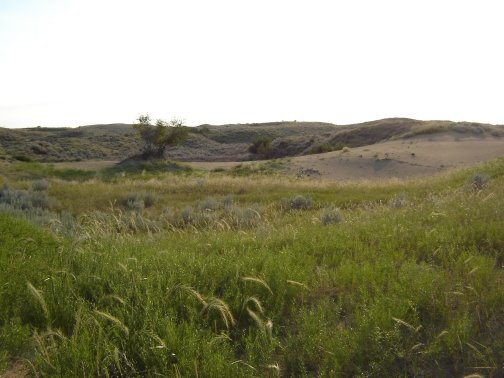
Mule deer on a dune partially revegetated with lance-leaved psoralea or scurf-pea (Psoralea lanceolata)

Alright, here's a bit about where I've been lately: the Great Sand Hills, in southwestern Saskatchewan. I find it fascinating that you can see the outline of the sandhill area on satellite imagery and on landcover maps derived from it. So much of southern Saskatchewan is in cropland that the major native grassland areas show up in contrast. One of these areas is the Great Sand Hills, where the soil is too sandy for annual crop production, and much of the topography is stabilized dunes, too choppy for any sort of cultivation. To me, the outline of the area looks a bit like a chess knight, or the upper part of a seahorse, in profile, facing right. See if you can see it on the landcover map when you zoom in on southwestern Saskatchewan. Look for a pinkish area south of the big bend in the South Saskatchewan River west of Lake Diefenbaker. Once you see it on there, try it on Google Earth.

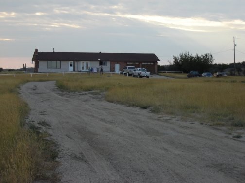
I joined the Plant Team, doing rare plant searches and range health assessment as part of the Great Sand Hills Regional Environmental Study, for ten days in the latter part of July. The team, with somewhat shifting membership as knowledgeable people were available, had been living at this rented ranch house in the west central part of the sandhills since late May.


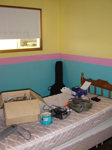
I took the last available bedroom. Hmmm - am I going to like this? Maybe once I take over the bed.

At least I had my guitar along.

Actually, I abandoned this room partly through my stay, and rolled out my sleeping bag in the basement rec room. Others did the same, and soon somebody commented about the refugee camp in the basement. It was just too hot upstairs in the early evening, when we were trying to get to sleep so that we could wake up and look lively at 4:30 a.m. At first we tried to leave the house at about six, but we gradually worked it back even earlier, so that we were arriving on our sites at about six. By eight o'clock in the morning, you could already feel the heat, and by the time we finished our last site of the day in the early afternoon, we were really needing some shade. Or an air conditioned truck. The drive back to the ranch was good for that. Often it was forty-five minutes; for some sites it was double that. "Oh, I drive a truck for the environment . . ."


At least I got to hang my laundry out to dry. I was amused and disturbed by the inconsistencies of our situation. At home I haven't even got around to putting up a clothesline, but I drive a tiny car, or bike, or walk. Out at this ranch, the plant people had brought along eco-friendly cleaning products and strung up a clothesline, and someone objected to the plastic sandwich bags I bought in the convenience store on a trip into town because I had forgotten to bring a reusable sandwich box - and we spent our days driving monstrous trucks all up and down the countryside. (Well, that and walking all up and down our sites.)

There were reasons, of course. We had to have vehicles with high clearance, to keep from dragging bottom or starting the crispy-crunchy-dry grass on fire. And part of the study design involved spreading the work over the whole area through the season, to avoid bias, so we couldn't just start at one end and camp our way across the area to save on driving.

Couldn't we just skip the study altogether? One team member was keen to see this study help to "keep them out" - to protect the sandhills from gas development. I reminded her that most of us depend on this gas to heat our homes each winter. As we discussed it further, she was shocked to learn that gas and oil development is often unwanted by landowners, but ultimately there is nothing they can do to stop it. If they refuse the developer's offer for a surface lease, and try to fight it, then an arbitration board will step in and tell them what they will be paid for the surface lease. They have no choice about giving a lease. Stepping back to look at the bigger picture, if some ranchers and environmentalists and concerned citizens band together and get some tighter planning restrictions on gas development in the sandhills, how long will it last? Eventually the pressure to get that gas will be too great, and the restrictions will be lifted.

But maybe the study will suggest some ways to do the development better, with less impact. I don't know. That wasn't my reason for being there. I just had fun wandering up and down sandhills, seeing the 360-degree vistas from the crests of dunes, bantering with my teammates. More than once I said I would do this work for free. When W saw me struggling up the side of a blowout, throwing the quadrat frame ahead of me and then lunging upward on all fours, he asked if I still felt the same way, or if maybe they weren't paying me enough for this. But I was still happy, just a bit embarrassed that I had tried to scramble up the steep and sliding sand instead of taking a long way around where the slope was easier, and feeling foolish with him standing up there watching me.

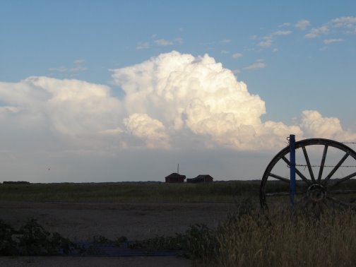
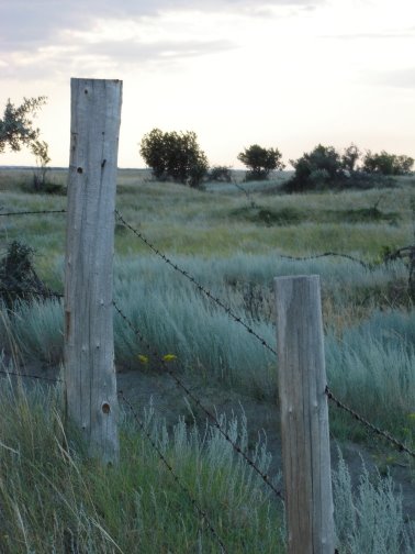
I meant to take the camera along on one of our workdays, but I was always too focussed on the stuff I needed for work. Even at that, I forgot my lunch one day. W and S gave me parts of theirs, and it was the best lunch I had in the whole ten days! Anyway, the only pictures I have are from the immediate vicinity of the ranch house where we stayed. They'll still give you some idea of what it was like.

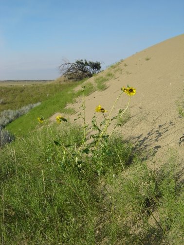
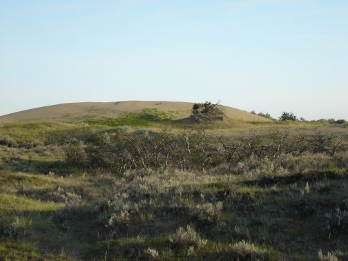
The work involved a lot of walking, back and forth in a set pattern across a site, while scanning all the vegetation in a 5 m wide swath for rare plants. Sometimes the site was flat open grassland, but sometimes it looked more like this.


Or this.


One site I recall had mostly creeping juniper at ground level, plus waist- to shoulder-high wolf willow (silverberry, Elaeagnus commutata) throughout. Then there was a site down in a broad low area where water table supports poplars and water birch - making it very difficult to see our flags to keep on track with the search pattern.

Once, while filling out a site form, W asked for my estimate of the % cover of a speargrass, Stipa comata. I said the estimate varies depending on what the botanist is wearing on their ankles.

I loved it all.

Some views of the dune north of the ranch house:


And looking back from the dune toward the ranch house:

I noticed a lot of terrain like this, where there is a low flat, bordered by higher, very rough land, known as "choppy dune." The ranch buildings seem to huddle at the edge of the flat, taking shelter from the sand ridges but staying out of them. The loneliness of the place was very appealing to me, as long as I didn't start thinking about what it would take to survive there, independently.


One night I stayed alone at the ranch. At the end of the ten-day shift, some of the team members were finished, and some had a four-day break before returning for another shift. All left for their homes or holidays, except for me. I stayed on to wait for Garth and James to pick me up so we could travel on westward to see Ruth's graduation from her three-week music program at the Air Cadet Summer Training Centre at Penhold, Alberta.

Something woke me - perhaps the wind slamming a bedroom door upstairs.

Soundtrack: crickets.


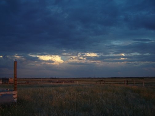
Look away from that yard light, and what do you see?

I see a glint on the horse trailers. Nothing more. No distant traffic, or yard lights, or glow from a town - nothing. Just the dark of the sandhill night.


Wednesday, August 02, 2006

Setting the Record . . .

. . . flat.

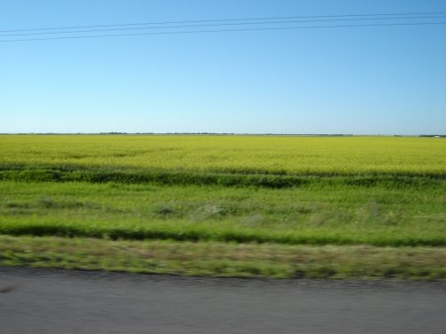
View northward from the TransCanada Highway between Regina and Moose Jaw.

This is the baseline, folks. No hills.

Thursday, July 13, 2006

Arcologist Comes Full Circle

One year ago today, I made my first post on this blog.

Earlier today, I posted "Hills" (below) as a special feature to celebrate. It seemed finished, and I was late for a date with Garth, so I published it even though I had a few pictures and thoughts left over.

Now, in the comments, I hear that some people are still unconvinced (wink). Well. Everything is relative. In the farmyard where my husband grew up, there is some place that they call "the hill." I know where it is because they talk about storing equipment "on the hill," and I've seen the equipment. I haven't seen the hill.

At least "hills" is more honest than their proper name, the Moose Mountains. Hummocks? Shall we call them hummocks? The Moose Hummocks. (giggle - I actually sort of like that as a name. That may give you some insight into my character.)

Ever notice how a camera flattens hills? Try it. This is my meme challenge: show me your hills.

And here are just a few more pictures from mine.

Taking a cue from Madcap Mum, for comparison purposes: here are some views from just outside the farm gate.

Looking north - looks flat, doesn't it? Except... that horizon is awfully close.


Looking south.


Looking home.

Hills

Some hills tend to cradle you.

These hills lift me to the sky.

I took this view for granted.

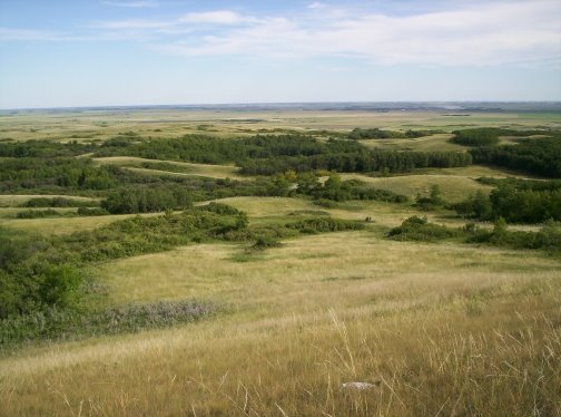
All those years growing up on my parents' farm, I could walk out to this hill just across from the house, just about any time I wanted. Almost looks like an aerial photo, doesn't it? But when I took this picture the other day, I was sitting on a rock. A small one. With my feet on the ground.

We kids used to go out to "the South Slopes," as we called this spot, in late winter when the sun was getting stronger and starting to melt the snow off a few small patches near the peaks of the biggest hills. I still remember the thrill of standing on that bare brown grass and earth, reconnecting with the ground for the first time in months.

We'd come out here to look for the first crocus buds, too.

When I walked out onto this hilltop a few years ago, when we had just moved back to the farm after fifteen years in the city, I was struck with a sudden realization. This view shaped the person that I am.

The other day, with my camera, I tried to capture a sense of the place, but it was quite beyond me. Perhaps if I'd had enough digital memory left for a video, I could have given you a glimmer of it. As it was, I got stingy with the pictures and didn't even zoom in on Arcola, so all you get is a blow-up of part of the scene above. This is my childhood view of the town where I now live.

It's just that band of dark green with some buildings showing in it, stretching across most of the width of this view of the distant "flats." I sometimes worry if I'll offend someone by saying "the flats," but our Arcola-Kisbey history book is subtitled "Mountain Hills to Prairie Flats," so I guess it's okay.

Arcola is about half a mile wide, I'd say. The road you can see in the middle distance is running from north to south away from the hills, and the next north-south road, one mile east of it, runs past the left end of the dark green area.

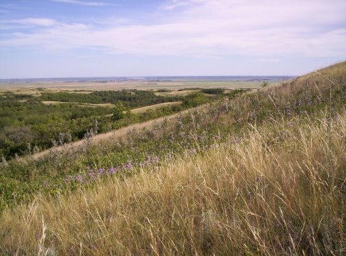
To give you a sense of how steep this hill is, here is another picture looking across its slope from a bit further east. You can tell by the horizon line on the flats - I didn't tilt the camera. (Okay, maybe a teeny bit. It's hard to stand up straight on that slope.)

And if you're thinking that's not steep, try climbing it. Or try browsing through some pictures of foothills. Most of the steeper slopes that you see are supported by rock formations. This is just glacial till. Here is a view of the "South Slopes" from the meadow below, looking west across their face.

If geology and ecology and botany bore you, skip along to some more pictures below.

I've been told that the Moose Mountains are a dead-ice moraine. When the last continental ice sheet was retreating, a chunk of the ice sat here and melted, dropping all the clay, sand, gravel, and boulders it contained in a great hummocky heap. If I recall correctly, the hollows are places where pieces of ice remained longer, so the earth materials settled around the edges of these lingering ice blocks, forming hills, and when the ice blocks finally melted out, they left holes that softened into hollows. All along the foot of the hills there are sand and gravel deposits, where streams running out of the melting ice slowed down as they entered the glacial lake to the south. The sand settled out of the water as it slowed. The silts and clays took much longer to settle out, so they were more-or-less evenly distributed across the lake bed, forming the flats.

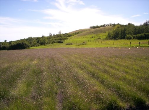
But we're still up in the hills, cradled in a meadow. I'll tell you a little bit about it. The crop in the foreground above is blue grama grass, a native species of short- and mixed-grass prairie, found most abundantly in dry upland areas. (Mom and Dad grow it for seed, for prairie reclamation projects.) This meadow was once a tame hayfield of yellow sweet-clover and smooth brome grass. Smooth brome was widely seeded as a hay crop and as a stabilizer for road ditches, and has taken over most of the "edge" area between grassland and wooded areas in our parklands. Any natural "edge" area - or "ecotone" as the biologists call it - is very important habitat to many wildlife species. My dad remarked that we probably don't know what "edge" used to be like here; brome grass has changed it, everywhere. In the photo above, you can see the extent of the brome grass, as the bright green area beyond the blue grama field, reaching to the edges of the trees and well up the slope of the hill.

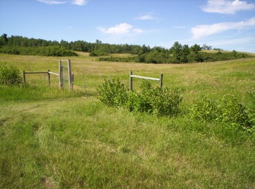
Ah, but it's a part of who we are. I have a song about that, called "The Whispers in the Brome." Maybe some other day. I still have lots more pictures. Here's another view in the meadow.

And on the other side of the meadow, south of those "South Slopes," we have "The Big Woods."

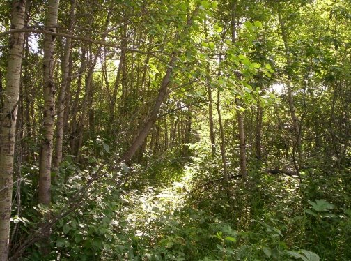
It's not the deepest, darkest view I could get, that's for sure. I love to thread my way through the bush and peer through beneath the understory for tiny flowers and mushrooms and such, but when it comes to taking pictures, I'm always drawn to the light. Besides, I was in the perpetual hurry that seems to haunt me these days, so I mostly kept to the not-so-natural trails.

The cattle had just been put into this pasture the day I rambled through it, so they hadn't grazed and trampled out the trails yet. Give them a few days. Then you can breeze through without having to dodge the stinging nettles, and maybe come away with only a couple of woodticks.

The "Big Woods" are a bit unusual in this landscape. They cover a broad low area that probably has water table fairly close to the surface, supporting black poplar (or balsam poplar, Populus balsamifera) and willows. Usually these species are found in smaller areas along the margins of sloughs and the bottoms of ravines.

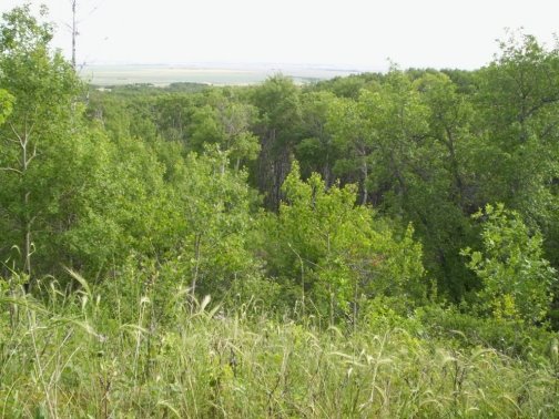
This is a view from the upper slope of a ravine at the west end of the "South Slopes." I didn't go down to the bottom. You can see a little bit into the shadows, but we're looking mostly at the crowns of the trees. The ravines are a different world. If it's hard work climbing the South Slopes, it's an ordeal climbing straight up through the tangle of thick underbrush on the side of one of these ravines. I've only done it a few times. Usually I seek out a good path before I start up. There is always a path along the bottom, where the cattle and deer and elk and moose follow the way of least resistance. There is good grazing and browsing there, too, even when the hills are dry, and in some of the deeper places there are springs.

Back up at the top of that slope, looking southwest, you can see the ravine running away through the center of the photo towards the flats. In the middle distance at the right side of the photo, you can see an area of more uniform grass cover. Again, it's an old field, now in tame pasture. Notice the contrast with the more diverse vegetation east of the ravine.

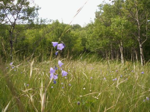
Time to turn for home. I did use a deceptive camera angle for this shot, getting down on elbows and knees to look through the needle-and-thread grass (Stipa comata) among the harebells (Campanula rotundifolia).

Oh, I still have more pictures, but it's time to go.